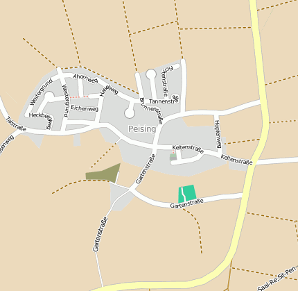
Bad Abbach Peising
Googlemaps
Fotos aus dem Umkreis von Bad Abbach Peising
Strassen in der Nähe vom Ortsteil Peising
- Turmweg (0.16km)
- St.-Georg-straße (0.19km)
- Ulmenweg (0.21km)
- Föhrenstraße (0.23km)
- Brunnenstraße (0.25km)
- Tannenstraße (0.25km)
- Gartenstraße (0.25km)
- Keltenstraße (0.26km)
- Haselweg (0.28km)
- Hopfenweg (0.33km)
- Kastanienweg (0.36km)
- Eichenweg (0.37km)
- Fichtenstraße (0.39km)
- Weidenweg (0.42km)
- Ahornweg (0.44km)
| Arbeitsmarktdaten von Bad Abbach, M | |
|---|---|
| Sozialversicherungspflichtige | |
| nach Wohnort | 4211 |
| nach Arbeitsort | 1906 |
| Einpendler | 1296 |
| Auspendler | 3601 |
| Geringfügig Beschäftigte (400€ Basis) | |
| nach Wohnort | 987 |
| nur GeB (Wohnort) | 618 |
| GeB als Nebenjob (Wohnort) | 369 |
| nach Arbeitsort | 1038 |
| nur GeB (Arbeitsort) | 661 |
| GeB als Nebenjob (Arbeitsort) | 377 |
| Arbeitslose | ca. 3.64% |
| Gesamt | 209 |
| davon ALG I | 132 |
| davon HARTZ 4 (ALG II) | 77 |
| Frauenquote | 43.54% |
| Männerquote | 56.46% |
| Ausländerquote | 6.7% |
| © Arbeitsagentur u.a. | |
| Fakten zur Gemeinde Bad Abbach, M | |
|---|---|
| Gemeindeschlüssel | 09273116 |
| Regionalschlüssel | 092730116116 |
| Gemeindetyp | Marktgemeinde |
| Verwaltung | Markt Bad Abbach Postfach 1253 93077 Bad Abbach |
| Bevölkerungsdichte | 200 Ew. je km² |
| Fläche | 55,31 km² |
| Einwohner | 11061 |
| davon weiblich | 5679 |
| davon männlich | 5382 |
| GPS Latitude | 48.920258 |
| GPS Longitude | 12.059235 |
| Vorwahl | 09405, 09453 |
| Telefonnetz | Bad Abbach, Thalmassing |
| Land | Bayern |
| Regierungsbezirk | Reg.-Bez. Niederbayern |
| Landkreis | Kelheim |
| Gemeinde | Bad Abbach, M |
| Aktive Googlemaps-Karte von Bad Abbach | |
| Aktive Openstreetmap-Karte von Bad Abbach | |
| Steuersätze von Bad Abbach, M | |||
|---|---|---|---|
| Ort | Grundsteuer A | Grundsteuer B | Gewerbesteuerhebesatz |
| Bad Abbach | 430 | 430 | 390 |
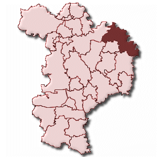
Gemeinde-Übersichtskarte(n)
Bad Abbach, Markt
Kartenausschnitt von Yahoo