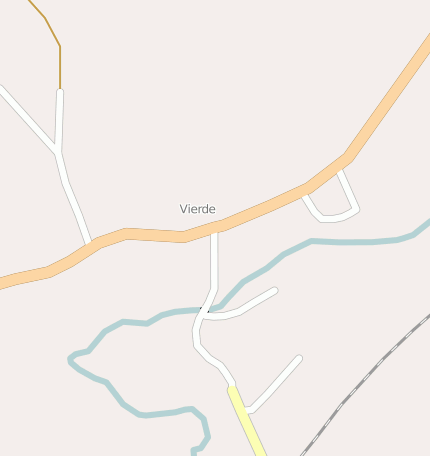
Bad Fallingbostel Vierde
Googlemaps
Fotos aus dem Umkreis von Bad Fallingbostel Vierde
Strassen in der Nähe vom Ortsteil Vierde
| Arbeitsmarktdaten von Bad Fallingbostel, Stadt | |
|---|---|
| Sozialversicherungspflichtige | |
| nach Wohnort | 3838 |
| nach Arbeitsort | 4841 |
| Einpendler | 3261 |
| Auspendler | 2258 |
| Geringfügig Beschäftigte (400€ Basis) | |
| nach Wohnort | 1118 |
| nur GeB (Wohnort) | 767 |
| GeB als Nebenjob (Wohnort) | 351 |
| nach Arbeitsort | 1343 |
| nur GeB (Arbeitsort) | 965 |
| GeB als Nebenjob (Arbeitsort) | 378 |
| Arbeitslose | ca. 6.7% |
| Gesamt | 366 |
| davon ALG I | 158 |
| davon HARTZ 4 (ALG II) | 208 |
| Frauenquote | 42.35% |
| Männerquote | 57.65% |
| Ausländerquote | 13.66% |
| © Arbeitsagentur u.a. | |
| Fakten zur Gemeinde Bad Fallingbostel, Stadt | |
|---|---|
| Gemeindeschlüssel | 03358008 |
| Regionalschlüssel | 033580008008 |
| Gemeindetyp | Stadt |
| Verwaltung | Stadt Fallingbostel Vogteistraße 1 29683 Fallingbostel |
| Bevölkerungsdichte | 183 Ew. je km² |
| Fläche | 63,49 km² |
| Einwohner | 11608 |
| davon weiblich | 5973 |
| davon männlich | 5635 |
| GPS Latitude | 52.882393 |
| GPS Longitude | 9.734384 |
| Vorwahl | 05162, 05163 |
| Telefonnetz | Fallingbostel, Fallingbostel-Dorfmark |
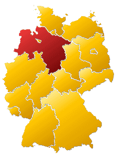
| Land | Niedersachsen |
| Regierungsbezirk | Bisher: Reg.-Bez. Lüneburg |
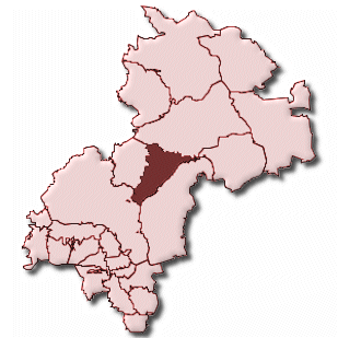
| Landkreis | Soltau-Fallingbostel |
| Gemeinde | Bad Fallingbostel, Stadt |
| Aktive Googlemaps-Karte von Bad Fallingbostel | |
| Aktive Openstreetmap-Karte von Bad Fallingbostel | |
| Steuersätze von Bad Fallingbostel, Stadt | |||
|---|---|---|---|
| Ort | Grundsteuer A | Grundsteuer B | Gewerbesteuerhebesatz |
| Bad Fallingbostel, Stadt | 310 | 310 | 340 |
Gemeinde-Übersichtskarte(n)
Bad Fallingbostel, Stadt
Kartenausschnitt von Yahoo