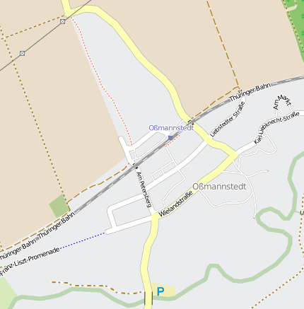
Oßmannstedt Oßmannstedt
Googlemaps
Fotos aus dem Umkreis von Oßmannstedt Oßmannstedt
Strassen in der Nähe vom Ortsteil Oßmannstedt
- Bahnhofstraße (0.04km)
- Dr.-Theodor-Neubauer-Siedlung (0.06km)
- Thomas-Müntzer-Siedlung (0.19km)
- Wilhelm-Pieck-Straße (0.21km)
- Wielandstraße (0.26km)
- Friedrich-Ludwig-Jahn-Straße (0.4km)
| Arbeitsmarktdaten von Oßmannstedt | |
|---|---|
| Sozialversicherungspflichtige | |
| nach Wohnort | 498 |
| nach Arbeitsort | 109 |
| Einpendler | 69 |
| Auspendler | 458 |
| Geringfügig Beschäftigte (400€ Basis) | |
| nach Wohnort | 53 |
| nur GeB (Wohnort) | 34 |
| GeB als Nebenjob (Wohnort) | 19 |
| nach Arbeitsort | 27 |
| nur GeB (Arbeitsort) | 20 |
| GeB als Nebenjob (Arbeitsort) | 7 |
| Arbeitslose | ca. 7.02% |
| Gesamt | 50 |
| davon ALG I | 26 |
| davon HARTZ 4 (ALG II) | 24 |
| Frauenquote | 36% |
| Männerquote | 64% |
| Ausländerquote | 0% |
| © Arbeitsagentur u.a. | |
| Fakten zur Gemeinde Oßmannstedt | |
|---|---|
| Gemeindeschlüssel | 16071072 |
| Regionalschlüssel | 160715004072 |
| Gemeindetyp | Kreisangehörige Gemeinde |
| Verwaltung | VG Ilmtal-Weinstraße Willerstedter Str. 1 99510 Pfiffelbach |
| Bevölkerungsdichte | 78 Ew. je km² |
| Fläche | 16,5 km² |
| Einwohner | 1283 |
| davon weiblich | 646 |
| davon männlich | 637 |
| GPS Latitude | 51.018677 |
| GPS Longitude | 11.424472 |
| Vorwahl | 036462 |
| Telefonnetz | Ossmannstedt |
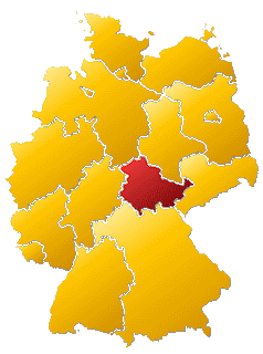
| Land | Thüringen |
| Landkreis | Weimarer Land |
| Gemeinde | Oßmannstedt |
| Aktive Googlemaps-Karte von Oßmannstedt | |
| Aktive Openstreetmap-Karte von Oßmannstedt | |
| Steuersätze von Oßmannstedt | |||
|---|---|---|---|
| Ort | Grundsteuer A | Grundsteuer B | Gewerbesteuerhebesatz |
| Oßmannstedt | 300 | 300 | 300 |
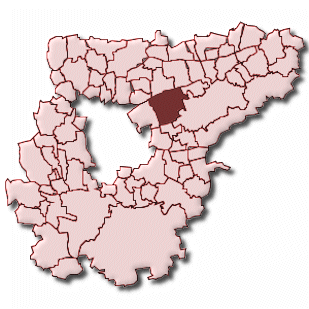
Gemeinde-Übersichtskarte(n)
Oßmannstedt
Kartenausschnitt von Yahoo