Schwäbisch Gmünd Hirschmühle
Googlemaps
Fotos aus dem Umkreis von Schwäbisch Gmünd Hirschmühle
Strassen in der Nähe vom Ortsteil Hirschmühle
- Unterer Mühlenweg (0.07km)
- Brühlweg (0.19km)
- Hirschmühlenstraße (0.2km)
- Erlenweg (0.29km)
- Burgholzstraße (0.45km)
- Burgholz (0.48km)
| Arbeitsmarktdaten von Schwäbisch Gmünd, Stadt | |
|---|---|
| Sozialversicherungspflichtige | |
| nach Wohnort | 18919 |
| nach Arbeitsort | 24646 |
| Einpendler | 13914 |
| Auspendler | 8187 |
| Geringfügig Beschäftigte (400€ Basis) | |
| nach Wohnort | 5601 |
| nur GeB (Wohnort) | 3746 |
| GeB als Nebenjob (Wohnort) | 1855 |
| nach Arbeitsort | 6374 |
| nur GeB (Arbeitsort) | 4361 |
| GeB als Nebenjob (Arbeitsort) | 2013 |
| Arbeitslose | ca. 8.63% |
| Gesamt | 2392 |
| davon ALG I | 915 |
| davon HARTZ 4 (ALG II) | 1477 |
| Frauenquote | 44.06% |
| Männerquote | 55.94% |
| Ausländerquote | 28.34% |
| © Arbeitsagentur u.a. | |
| Fakten zur Gemeinde Schwäbisch Gmünd, Stadt | |
|---|---|
| Gemeindeschlüssel | 08136065 |
| Regionalschlüssel | 081365007065 |
| Gemeindetyp | Große Kreisstadt |
| Verwaltung | Stadt Schwäbisch Gmünd Marktplatz 1 73525 Schwäbisch Gmünd |
| Bevölkerungsdichte | 533 Ew. je km² |
| Fläche | 113,78 km² |
| Einwohner | 60682 |
| davon weiblich | 31317 |
| davon männlich | 29365 |
| GPS Latitude | 48.811829 |
| GPS Longitude | 9.867734 |
| Vorwahl | 07171, 07173, 07332 |
| Telefonnetz | Schwäbisch Gmünd, Heubach, Lauterstein |
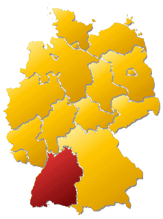
| Land | Baden-Württemberg |
| Regierungsbezirk | Reg.-Bez. Stuttgart |
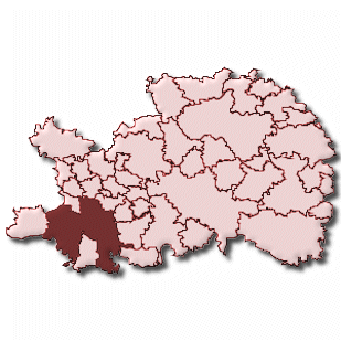
| Landkreis | Ostalbkreis |
| Gemeinde | Schwäbisch Gmünd, Stadt |
| Aktive Googlemaps-Karte von Schwäbisch Gmünd | |
| Aktive Openstreetmap-Karte von Schwäbisch Gmünd | |
| Steuersätze von Schwäbisch Gmünd, Stadt | |||
|---|---|---|---|
| Ort | Grundsteuer A | Grundsteuer B | Gewerbesteuerhebesatz |
| Schwäbisch Gmünd, Stadt | 320 | 390 | 360 |
Gemeinde-Übersichtskarte(n)
Schwäbisch Gmünd, Stadt