
Mathystraße
Mathystraße wird klassifiziert als:
- Kreisstraße, sehr gut ausgebaute Gemeindeverbindungsstraße
Googlekarten
Quelle: OpenStreetMap
| In der Nähe von ,,Mathystraße´´ | |
|---|---|
| Bahnhofsanlage | Schloß Rüppurr, Karlsruhe-Albtalbahnhof, Dammerstock, Rüppurr Ostendorfplatz, Karlsruhe Albtalbahnhof, Karlsruhe Hbf, Karlsruhe Gbf |
| Flugplatz | Karlsruhe AAF |
| Freizeitanlage | Tierpark Oberwald |
| Gebäude | Sankt-Vincentius-Kliniken Karlsruhe, Zentrum für Kunst und Medientechnologie Karlsruhe, Bundesgerichtshof, Staatliches Museum für Naturkunde Karlsruhe, Regierungspräsidium Karlsruhe, Staatliche Kunsthalle Karlsruhe, Bundesverfassungsgericht, Badisches Landesmuseum im Schloss Karlsruhe, Schloss Karlsruhe, Synagoge und Gemeindezentrum Knielinger Allee Karlsruhe, Städtisches Klinikum Karlsruhe |
| Hubschrauberlandeplatz | Karlsruhe, Sankt Vincentius-Kliniken, Karlsruhe, Klinikum |
| Industrie- und Gewerbefläche | Karlsruhe |
| Stadion | Wildparkstadion |
Fotos aus der Nähe Mathystraße

 (von Phalanx1984)
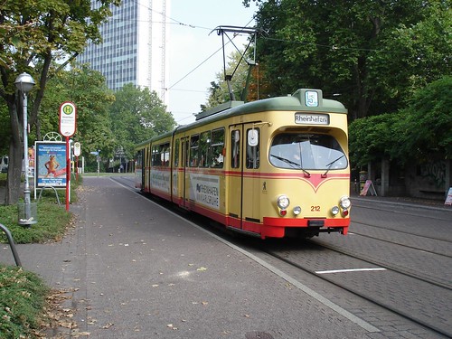


Strassen in der Nähe von ``Mathystraße´´
- Renckstraße (0.12km)
- August-Dürr-Straße (0.14km)
- Ritterstraße (0.21km)
- Augustastraße (0.29km)
- Mathystraße (0.29km)
- Festplatz (0.29km)
- Beiertheimer Allee (0.31km)
- Sonntagstraße (0.33km)
- Redtenbacherstraße (0.34km)
- Hermann-Billing-Straße (0.37km)
- Friedrich-Scholl-Platz (0.38km)
- Kriegsstraße (0.39km)
- Kriegsstraße (0.39km)
- Kriegsstraße (0.39km)
- Gartenstraße (0.39km)
- Badenwerkstraße Am Festplatz (0.4km)
- Friedenstraße (0.41km)
- Gutschstraße (0.48km)
- Karlstraße (0.48km)
- Kantstraße (0.54km)
- Leibnizstraße (0.58km)
Geografische Punkte und Wege aus OpenStreetmap in der Nähe von ``Mathystraße´´
- Jollystraße
- Sonntagstraße
- Mathystraße
- Die Radecke
- Bäckerei Konditorei Meier
- Waldstraße
- Sonntagstraße
- Friedenstraße
- Südendstraße
- Brille 40 Plus Balam
- Klauprechtstraße
- Evangelischer Kindergarten Friedenstraße
- La Tegola
- Kriegsstraße
- Leibnizstraße
- Kriegsstraße
- Leibnizstraße
- Kriegsstraße
- Fichtegymnasium
- Kriegsstraße
- Augustastraße
- Leibnizstraße
- Mathystraße
- KashKa
- Redtenbacherstraße
- Kolpingplatz
- ehemalige Kurvenbahn
- Die Gurke
- Karlstraße
- Kolpingplatz
- Karlstraße
- Kolpingplatz
- Karlstraße
- Parkplatz dm
- Fotostudio Becker
- Karlstraße
- Mediterrane
- Augusta-Apotheke
- Saigon Wok
- Kolpingplatz
- Karlstraße
- Feldschlösschen
- Gartenstraße
- Karlstraße
- Alter Brauhof
- Sophienstraße
- Penny Markt Parkplatz
- Karlstraße
- Karlstraße
- Karlstraße
- Zwerg-Nase-Brunnen
- Long Life
- Karlstor
- Basislager
- Pomodoro
- Wolfgang Barth - Kundendienst-Zentrale für Elektronik
- Bäckerei & Konditorei Fütterer
- Theodor Steinmann Haus
- Mathystraße (Mathystraße)
- Springbrunnen
- Pension Central
- Memo Restaurant
- dm
- La Bottega
- Kolpingplatz
- Kilimandscharo
- Astoria
- Unicef
- Kolpingplatz
- Mathystraße (Mathystraße)
- Casino
- gebaka
- Panorama
- STIEGELES RESTAURANT
- Hotel Astoria
- Springbrunnen
- Brauss
- Haarhaus Karlsruhe
- BB-Bank
- Mastar
- SBar
- Mathystraße (Karlstraße)
- Schierle
- Da Gianni
- Santo
- Karlstor
- Mathystraße (Karlstraße)
- Stadtplan Karlsruhe
- Hotel am Karlstor
- Südwestapotheke
- Journal
- Edeka
- Witwit take away
- Da Serio
- Neff
- Rossmann
- Penny
- Karlstor
- Café Classico
- Taj Palace


