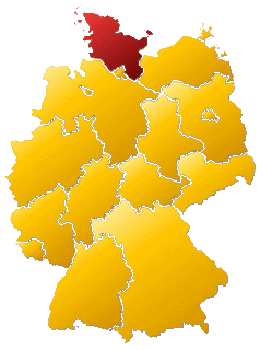
Friedrichstadt
Friedrichstadt wird klassifiziert als:
Quelle: OpenStreetMap
| In der Nähe von ,,Friedrichstadt´´ | |
|---|---|
| Bahnhofsanlage | Düsseldorf-Friedrichstadt, Düsseldorf-Lierenfeld, Düsseldorf-Oberbilk, Düsseldorf Wehrhahn, Düsseldorf Zoo, Düsseldorf Hbf, Düsseldorf Volksgarten, Düsseldorf-Bilk (Hp), Düsseldorf Völklinger Straße, Düsseldorf-Bilk, Bahnhof Düsseldorf-Bilk |
| Brücke, Überführung, Unterführung | Oberkasseler Brücke, Rheinkniebrücke |
| Farm / Landwirtschaft | Stoffeln, Brückerhof |
| Gebäude | Evangelisches Krankenhaus Düsseldorf, Bezirksregierung Düsseldorf, Landtag Nordrhein-Westfalen, Johanneskirche, Universitätsklinikum Düsseldorf |
| Hubschrauberlandeplatz | Düsseldorf, Universitätsklinikum |
| Industrie- und Gewerbefläche | Volmerswerth, Düsseldorf |
| Stadion | Stadion Feuerbachstraße, Eisstadion Brehmstraße |
| Turm | Rheinturm |
| Verkehrsknoten | Düsseldorf-Bilk, Düsseldorf-Wersten |
| Wasserlauf | Innere Südliche Düssel, Innere Nördliche Düssel |
Fotos aus der Nähe Friedrichstadt
Strassen in der Nähe von ``Friedrichstadt´´
- Fürstenwall (0.13km)
- Jahnstraße (0.19km)
- Kirchfeldstraße (0.2km)
- Morsestraße (0.21km)
- Talstraße (0.22km)
- Keplerstraße (0.24km)
- Bilker Allee (0.26km)
- Fürstenplatz (0.27km)
- Kirchfeldstraße (0.27km)
- Herzogstraße (0.31km)
- Oberbilker Allee (0.32km)
- Friedrichstraße (0.33km)
- Friedrichstraße (0.33km)
- Hildebrandtstraße (0.34km)
- Kirchplatz (0.35km)
- Philipp-Reis-Straße (0.35km)
- Zimmerstraße (0.37km)
- Weberstraße (0.37km)
- Herzogstr. (0.43km)
- Herzogstraße (0.43km)
- Hüttenstraße (0.44km)
- Färberstraße (0.45km)
- Luisenstraße (0.51km)
- Ernst-Reuter-Platz (0.55km)
- Gogrevestraße (0.57km)
- Vlattenstraße (0.58km)
Geografische Punkte und Wege aus OpenStreetmap in der Nähe von ``Friedrichstadt´´
- Aachener Straße
- Bahnhofshalle
- Bahnhofshalle
- Ludwig-Hammers-Platz
- Ludwig-Hammers-Platz
- Friedrichstraße
- Zufahrt REAL
- Talstraße
- REAL
- Königsallee
- Weberstraße
- Kirchfeldstraße
- Jahnstraße
- Esmarchstraße
- Jahnstraße
- Bilker Allee
- Herzogstraße
- Luisenstraße
- Hüttenstraße
- Heresbachstraße
- Corneliusstraße
- Karl-Rudolf-Straße
- Erasmusstraße
- Kirchfeldstraße
- Hüttenstraße
- 707, 708
- Corneliusstraße
- Keplerstraße
- Fürstenwall
- Luisenstraße
- Morsestraße
- 707, 708
- Fürstenplatz
- Fürstenplatz
- Fürstenplatz
- Philipp-Reis-Straße
- Färberstraße
- Kirchfeldstraße
- Pionierstraße
- Fürstenplatz
- Fürstenplatz
- Philipp-Reis-Straße
- Fürstenplatz
- Remscheider Straße
- widder Apotheke
- Mekong
- Rossmann
- basic Bio-Supermarkt
- Il Mercato
- Deichmann
- Magno
- TG Kirchplatz
- Subway
- Friedrich Apotheke
- Rad ab
- Bahnhofskiosk
- Leistenschneider
- Kirchplatz
- Kirchplatz
- Café Cajú
- Bilk S/Friedrichstraße
- bonita
- Bilk S
- Bilk S
- Aldi-Süd
- Buchhaus Stern-Verlag
- Stern-Verlag
- Bilk S
- Kirchplatz
- Cemo
- Hähnchengrill
- Kath. KiTa & Hort St. Peter
- Q-Park
- Stern-Verlag
- Hotel an der Kö
- City Squash
- Buchhaus Stern-Verlag
- FSFE
- Hoffmanns gute Küche
- Stern-Verlag
- Familienzentrum Weberstraße
- Bodycare
- TG Real
- Tageseinrichtung für Kinder - Fürstenwall 186a
- Jecht K & M
- FFT Kammerspiele
- Hotel Diana
- coworking space Garage Bilk
- Jung&Volke
- Friedrichstadt
- Four Points
- La Lampada
- Rettungswache MHD
- Anfora Türk. Rest.


 (von Dominik Schwind)


